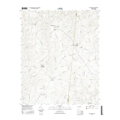
2016 Map of Olive Branch
USGS Topo · Published 2016About this map
Richardson Creek and its many tributaries, such as Little Water Br and Gourdine Cr, define the drainage patterns of this rural landscape along the Union and Anson county line. The map highlights a strong tradition of local religious and family life, centered around settlements like Olive Branch and Hamilton Crossroads. Genealogists will find a concentration of family-named landmarks, including the Baucom Family Cem and Godwin Family Cem, alongside established congregations such as Fountain Hill United Methodist and the Olive Branch Missionary Baptist Church.
Find a feature on this map
109 named features on this map. Tap any name to fly to it.
Don’t see what you’re looking for? This feature index may not catch every label — zoom into the map to look around manually.
Map Details
Editions of this 2016 Olive Branch Map
This is the sole edition of this map. No revisions or reprints were ever made.
Other maps of this area
1941 · Spartanburg
USGS Topo · 1:250,000
1953 · Spartanburg
USGS Topo · 1:250,000
1953 · Charlotte
USGS Topo · 1:250,000
1954 · Charlotte
USGS Topo · 1:250,000
1960 · Charlotte
USGS Topo · 1:250,000
1960 · Spartanburg
USGS Topo · 1:250,000
1962 · Charlotte
USGS Topo · 1:250,000
1963 · Spartanburg
USGS Topo · 1:250,000
1964 · Spartanburg
USGS Topo · 1:250,000
1970 · Watson
USGS Topo · 1:24,000