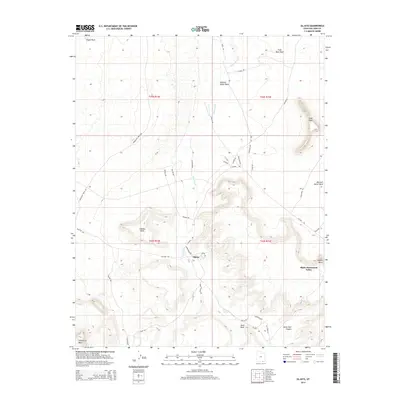
2014 Map of Oljato
USGS Topo · Published 2014About this map
Oljato serves as a central hub in this high-desert landscape, located near the border of Oljato-Monument Valley. The terrain is defined by massive sandstone formations including Holiday Mesa, Oljato Mesa, and Hoskinnini Mesa, which rise sharply above the surrounding drainage networks. Significant geological landmarks such as Organ Rock, Anvil Rock, and Train Rock stand as distinctive navigational points. Water, while scarce, is marked by the seasonal courses of Oljato Wash and Train Rock Wash, alongside the vital Oljato Spring. The road network, featuring names like Moonlight Ridge Rd and Pollen Rd, suggests a landscape shaped by both traditional land use and modern access. The proximity of Mitchell Butte Wash and Horse Trail Canyon highlights the intricate erosion patterns that characterize this portion of San Juan County.
Find a feature on this map
42 named features on this map. Tap any name to fly to it.
Don’t see what you’re looking for? This feature index may not catch every label — zoom into the map to look around manually.
Map Details
Editions of this 2014 Oljato Map
This is the sole edition of this map. No revisions or reprints were ever made.
Other maps of this area

1883 · Marsh Pass
USGS Topo · 1:250,000

1886 · Henry Mountains
USGS Topo · 1:250,000

1892 · Marsh Pass
USGS Topo · 1:250,000

1892 · Henry Mountains
USGS Topo · 1:250,000

1952 · Clay Hills 4 SW
USGS Topo · 1:24,000

1952 · Clay Hills 3 SE
USGS Topo · 1:24,000

1952 · Agathla Peak 1 NW
USGS Topo · 1:24,000

1952 · Agathla Peak 2 NW
USGS Topo · 1:24,000

1952 · Boot Mesa
USGS Topo · 1:62,500

1952 · Clay Hills 3 SW
USGS Topo · 1:24,000