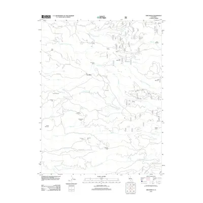
2012 Map of Omo Ranch
USGS Topo · Published 2012About this map
Omo Ranch and the surrounding Sierra Nevada foothills are defined by a complex drainage system where the Steely Fork Cosumnes River, Middle Fork Cosumnes River, and S Fork Cosumnes River carve through the landscape. This 2012 survey illustrates the transition from historic mining activity to modern forestry and rural residency. Signs of the area's industrial past remain visible through features like Henrys Diggings, Loveless Dredgings, and the Andreason Mill. Local history and genealogy are anchored by several notable sites, including the Indian Diggins Cem near Marble Springs and the Andreason Cem further south. The map details a network of ridges and gulches, such as Farnham Ridge and Slug Gulch, alongside small settlements like Brownsville and the high-elevation Leoni Meadow. Water resources are central to the terrain, featuring the Big Reservoir and Little Reservoir along the winding Indian Diggins RD.
Find a feature on this map
61 named features on this map. Tap any name to fly to it.
Don’t see what you’re looking for? This feature index may not catch every label — zoom into the map to look around manually.
Map Details
Editions of this 2012 Omo Ranch Map
This is the sole edition of this map. No revisions or reprints were ever made.
Other maps of this area

1889 · Jackson
USGS Topo · 1:125,000

1889 · Pyramid Peak
USGS Topo · 1:125,000

1891 · Big Trees
USGS Topo · 1:125,000

1891 · Placerville
USGS Topo · 1:125,000

1891 · Pyramid Peak
USGS Topo · 1:125,000

1892 · Jackson
USGS Topo · 1:125,000

1892 · Placerville
USGS Topo · 1:125,000

1893 · Placerville
USGS Topo · 1:125,000

1894 · Big Trees
USGS Topo · 1:125,000

1895 · Pyramid Peak
USGS Topo · 1:125,000