2022 Map of Onalaska
USGS Topo · Published 2022About this map
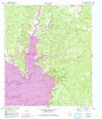
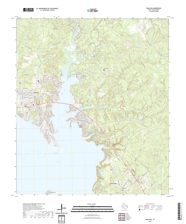
Lake Livingston dominates this portion of Polk County, where the impounded waters of the Trinity River have created a complex shoreline of inlets and coves. The landscape is defined by residential developments such as Cedar Point and West Tempe, which are situated along the dendritic fingers of the lake. These settlements reflect a mid-to-late 20th-century shift toward lakeside living, replacing the older rural patterns of the East Texas piney woods. Numerous small family and community burial sites remain as anchors to the area's earlier history, including the Modica Family Cem and the Wright Cem. To the north, the terrain transitions into a network of small creeks like Rocky Creek and Manning Br, where legacy roads such as Delafosse Cemetery Rd and Sapp Rd wind through the remaining woodland and established cemeteries like Saint Andrews Cem.
Find a feature on this map
147 named features on this map. Tap any name to fly to it.
Don’t see what you’re looking for? This feature index may not catch every label — zoom into the map to look around manually.
Map Details
Editions of this 2022 Onalaska Map
This is the sole edition of this map. No revisions or reprints were ever made.