1961 Map of Onalaska
USGS Topo · Published 1991About this map
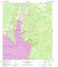
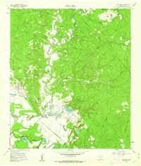
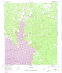
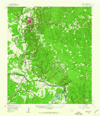
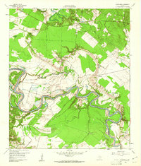
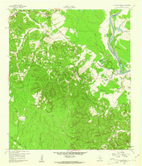
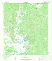
Kickapoo Lake Livingston dominates this landscape, showing the dramatic transformation of the Trinity River basin as areas were marked for controlled inundation. The town of Onalaska stands at the western edge of the rising waters, featuring the Onalaska Lookout and nearby Tin Top Ch. The 1972 revisions captured in purple highlight how the expanding reservoir reshaped the local geography, submerging segments of the Kickapoo Creek valley while sparing higher ground settlements like West Tempe.
Find a feature on this map
36 named features on this map. Tap any name to fly to it.
Don’t see what you’re looking for? This feature index may not catch every label — zoom into the map to look around manually.
Map Details
Editions of this 1961 Onalaska Map
4 editions found
Other maps of this area

1954 · Beaumont
USGS Topo · 1:250,000
1955 · New Willard
USGS Topo · 1:62,500

1957 · Beaumont
USGS Topo · 1:250,000
1958 · Livingston
USGS Topo · 1:62,500
1960 · Blanchard
USGS Topo · 1:24,000
1960 · Colita
USGS Topo · 1:24,000
1960 · Carlisle
USGS Topo · 1:24,000
1960 · Stephen Creek
USGS Topo · 1:24,000
1961 · Onalaska
USGS Topo · 1:24,000

1984 · Beaumont
USGS Topo · 1:250,000