
1960 Map of Blanchard
USGS Topo · Published 1961About this map
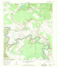
The Trinity River snakes through the bottomlands of Polk and San Jacinto counties, defining a landscape of complex waterways and dense vegetation before the massive reservoir projects of later decades. This 1960 survey captures the rural character of the region, anchored by the settlement of Blanchard and the historical location of Tigerville. The terrain is marked by a network of seasonal sloughs and creeks, including Indian Slough, Penwa Slough, and the uniquely named Alligator Hole.
Find a feature on this map
30 named features on this map. Tap any name to fly to it.
Don’t see what you’re looking for? This feature index may not catch every label — zoom into the map to look around manually.
Map Details
Editions of this 1960 Blanchard Map
Other maps of this area

1954 · Beaumont
USGS Topo · 1:250,000

1955 · New Willard
USGS Topo · 1:62,500

1957 · Beaumont
USGS Topo · 1:250,000

1958 · Livingston
USGS Topo · 1:62,500

1960 · Carlisle
USGS Topo · 1:24,000

1960 · Stephen Creek
USGS Topo · 1:24,000

1960 · Camilla
USGS Topo · 1:24,000

1960 · Coldspring
USGS Topo · 1:24,000

1961 · Onalaska
USGS Topo · 1:24,000

1984 · Beaumont
USGS Topo · 1:250,000