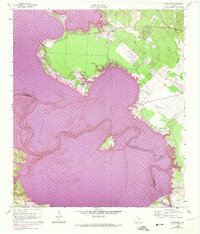
1960 Map of Blanchard
USGS Topo · Published 1974About this map
Lake Livingston dominates this landscape, showing a significant transformation of the Trinity River valley. This 1974 photorevised edition highlights areas subject to controlled inundation in purple, illustrating the creation of the reservoir. Along the shoreline, settlements like Blanchard and Tigerville remain above the water line, while the southern reaches of the map near Swartout track the river's original winding path along the Polk Co San Jacinto Co boundary. The map captures a mix of old transport and modern infrastructure, from an Old Railroad Grade north of Tempe Creek to the Livingston Municipal Airport and a prominent Pipeline. Local landmarks such as Garner Chapel and Moore Hill provide specific points of interest for genealogists and researchers tracking the evolution of East Texas communities during the mid-20th century.
Find a feature on this map
17 named features on this map. Tap any name to fly to it.
Don’t see what you’re looking for? This feature index may not catch every label — zoom into the map to look around manually.
Map Details
Editions of this 1960 Blanchard Map
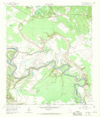
Other maps of this area

1954 · Beaumont
USGS Topo · 1:250,000

1955 · New Willard
USGS Topo · 1:62,500

1957 · Beaumont
USGS Topo · 1:250,000

1958 · Livingston
USGS Topo · 1:62,500

1960 · Blanchard
USGS Topo · 1:24,000

1960 · Carlisle
USGS Topo · 1:24,000

1960 · Stephen Creek
USGS Topo · 1:24,000

1960 · Camilla
USGS Topo · 1:24,000

1960 · Coldspring
USGS Topo · 1:24,000

1961 · Onalaska
USGS Topo · 1:24,000