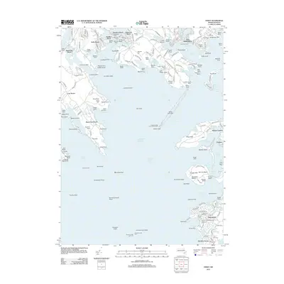
2012 Map of Onset
USGS Topo · Published 2012About this map
Bird Island Light stands at the entrance to Sippican Harbor, marking a coast defined by intricate necks, coves, and beach-front communities. The maritime character of the area is further emphasized by the Onset Town Wharf and several navigational aids, including the Cleveland Ledge Lighthouse situated offshore. This coastal topography reveals a high density of summer settlements and established neighborhoods like Point Independence and Silver Beach, many of which grew around the natural harbors and rivers like the Weweantic River and Agawam River.
Find a feature on this map
210 named features on this map. Tap any name to fly to it.
Don’t see what you’re looking for? This feature index may not catch every label — zoom into the map to look around manually.
Map Details
Editions of this 2012 Onset Map
This is the sole edition of this map. No revisions or reprints were ever made.
Other maps of this area

1885 · New Bedford
USGS Topo · 1:62,500

1885 · Middleboro
USGS Topo · 1:62,500

1886 · Falmouth
USGS Topo · 1:62,500

1886 · Plymouth
USGS Topo · 1:62,500

1888 · New Bedford
USGS Topo · 1:62,500

1888 · Falmouth
USGS Topo · 1:62,500

1888 · Middleboro
USGS Topo · 1:62,500

1889 · Plymouth
USGS Topo · 1:62,500

1893 · Middleboro
USGS Topo · 1:62,500

1893 · Falmouth
USGS Topo · 1:62,500