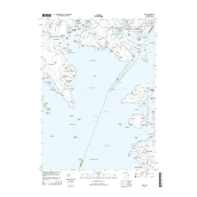
2015 Map of Onset
USGS Topo · Published 2015About this map
Weweantic River flows into the protected waters of this coastal landscape, where the maritime character of the region is defined by a dense network of necks, points, and coves. Established summer colonies and year-round settlements like Onset and Point Independence are clustered around the sheltered Onset Bay, while the expansive Great Neck separates the inland rivers from the open Atlantic Ocean. The presence of the Intracoastal Waterway and the Cleveland Ledge Channel underscores the area's importance for coastal navigation. On the eastern shore, the geography shifts toward Pocasset Harbor and the residential reaches of Barlows Landing and Patuisset. This survey provides a look at the intricate coastline before modern changes, documenting family and local landmarks from Monument Beach Cem to the beach-front developments at Silver Beach and Hamilton Beach.
Find a feature on this map
182 named features on this map. Tap any name to fly to it.
Don’t see what you’re looking for? This feature index may not catch every label — zoom into the map to look around manually.
Map Details
Editions of this 2015 Onset Map
This is the sole edition of this map. No revisions or reprints were ever made.
Other maps of this area

1885 · New Bedford
USGS Topo · 1:62,500

1885 · Middleboro
USGS Topo · 1:62,500

1886 · Falmouth
USGS Topo · 1:62,500

1886 · Plymouth
USGS Topo · 1:62,500

1888 · New Bedford
USGS Topo · 1:62,500

1888 · Falmouth
USGS Topo · 1:62,500

1888 · Middleboro
USGS Topo · 1:62,500

1889 · Plymouth
USGS Topo · 1:62,500

1893 · Middleboro
USGS Topo · 1:62,500

1893 · Falmouth
USGS Topo · 1:62,500