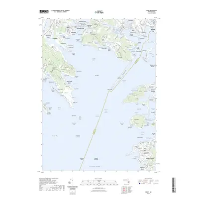
2023 Map of Onset
USGS Topo · Published 2023About this map
The salt marshes and convoluted inlets of Buzzards Bay dominate this 2023 survey of the Upper Cape region. Densely settled coastal communities like Onset and Wareham Center are characterized by tight street grids that contrast with the expansive wetlands of Marks Cove Marshes and Little Harbor Marshes. The geography is defined by a series of long necks and points, including Cromeset Neck and Indian Neck, reaching into tidal waters such as the Weweantic River and Sippican Harbor.
Find a feature on this map
230 named features on this map. Tap any name to fly to it.
Don’t see what you’re looking for? This feature index may not catch every label — zoom into the map to look around manually.
Map Details
Editions of this 2023 Onset Map
This is the sole edition of this map. No revisions or reprints were ever made.
Other maps of this area

1885 · New Bedford
USGS Topo · 1:62,500

1885 · Middleboro
USGS Topo · 1:62,500

1886 · Falmouth
USGS Topo · 1:62,500

1886 · Plymouth
USGS Topo · 1:62,500

1888 · New Bedford
USGS Topo · 1:62,500

1888 · Falmouth
USGS Topo · 1:62,500

1888 · Middleboro
USGS Topo · 1:62,500

1889 · Plymouth
USGS Topo · 1:62,500

1893 · Middleboro
USGS Topo · 1:62,500

1893 · Falmouth
USGS Topo · 1:62,500