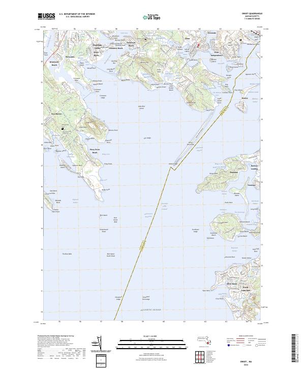
2024 Map of Onset
USGS Topo · Published 2024About this map
Onset Harbor and the intricate coastal geometry of Buzzards Bay define this maritime landscape. The village of Onset serves as a central hub, flanked by the residential developments of Independence and Riverside along the East River. The topography is dominated by numerous necks and points, such as Sippican Neck and Indian Neck, which shelter coves like Blankenship Cove and Wings Cove. These natural harbors supported a long history of maritime activity and summer settlement.
Find a feature on this map
231 named features on this map. Tap any name to fly to it.
Don’t see what you’re looking for? This feature index may not catch every label — zoom into the map to look around manually.
Map Details
Editions of this 2024 Onset Map
This is the sole edition of this map. No revisions or reprints were ever made.
Other maps of this area

1885 · New Bedford
USGS Topo · 1:62,500

1885 · Middleboro
USGS Topo · 1:62,500

1886 · Falmouth
USGS Topo · 1:62,500

1886 · Plymouth
USGS Topo · 1:62,500

1888 · New Bedford
USGS Topo · 1:62,500

1888 · Falmouth
USGS Topo · 1:62,500

1888 · Middleboro
USGS Topo · 1:62,500

1889 · Plymouth
USGS Topo · 1:62,500

1893 · Middleboro
USGS Topo · 1:62,500

1893 · Falmouth
USGS Topo · 1:62,500