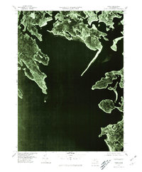
1977 Map of Onset
USGS Topo · Published 1981About this map
Buzzards Bay and the intricate coastal fingers of the Massachusetts shoreline define this 1977 orthophotoquad. The landscape is dominated by the narrow peninsulas of Sipican Neck and Great Neck, which reach southward into the bay. This aerial perspective, prepared by the Department of the Interior, reveals the concentrated settlement patterns of the late 1970s, particularly around the sheltered waters of Onset and Point Independence.
Find a feature on this map
10 named features on this map. Tap any name to fly to it.
Don’t see what you’re looking for? This feature index may not catch every label — zoom into the map to look around manually.
Map Details
Editions of this 1977 Onset Map
This is the sole edition of this map. No revisions or reprints were ever made.
Other maps of this area

1885 · New Bedford
USGS Topo · 1:62,500

1885 · Middleboro
USGS Topo · 1:62,500

1886 · Falmouth
USGS Topo · 1:62,500

1886 · Plymouth
USGS Topo · 1:62,500

1888 · New Bedford
USGS Topo · 1:62,500

1888 · Falmouth
USGS Topo · 1:62,500

1888 · Middleboro
USGS Topo · 1:62,500

1889 · Plymouth
USGS Topo · 1:62,500

1893 · Middleboro
USGS Topo · 1:62,500

1893 · Falmouth
USGS Topo · 1:62,500