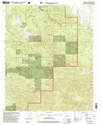
1996 Map of Onyx Peak
USGS Topo · Published 1999About this map
Onyx Peak stands as the central high point of this high-altitude landscape in the San Bernardino National Forest. Revised in the mid-1990s, the map reveals a rugged terrain defined by sharp ridgelines like Heartbreak Ridge and deep drainage systems including Pipes Canyon and Little Morongo Canyon. The presence of the Pacific Crest National Scenic Trail winding through the southwestern section reflects the area's role in long-distance recreation, supported by backcountry locations such as Coon Creek Jumpoff and the Coon Creek Cabin Group.
Find a feature on this map
37 named features on this map. Tap any name to fly to it.
Don’t see what you’re looking for? This feature index may not catch every label — zoom into the map to look around manually.
Map Details
Editions of this 1996 Onyx Peak Map
This is the sole edition of this map. No revisions or reprints were ever made.
Other maps of this area

1901 · Southern California Sheet No. 1
USGS Topo · 1:250,000

1902 · San Gorgonio
USGS Topo · 1:125,000

1904 · Southern California Sheet No. 1
USGS Topo · 1:250,000

1947 · Lucerne Valley
USGS Topo · 1:62,500

1949 · Lucerne Valley
USGS Topo · 1:62,500

1953 · San Bernardino
USGS Topo · 1:250,000

1954 · San Gorgonio Mountain
USGS Topo · 1:62,500

1955 · Old Woman Springs
USGS Topo · 1:62,500

1955 · Morongo Valley
USGS Topo · 1:62,500

1956 · San Bernardino
USGS Topo · 1:250,000