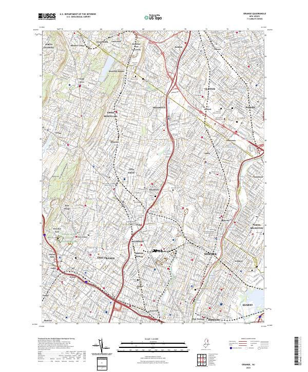
2023 Map of Orange
USGS Topo · Published 2023About this map
Thomas Edison National Historical Park and the nearby Edison Gravesite anchor the historic landscape of West Orange, marking the legacy of invention in Essex County. This dense urban corridor transition from the slopes of First Watchung Mountain and Stony Hill down to the industrial reaches of the Passaic River. The map reveals a complex network of established neighborhoods and specialized districts, such as Ampere and Watsessing, that grew around turn-of-the-century manufacturing and rail infrastructure.
Find a feature on this map
92 named features on this map. Tap any name to fly to it.
Don’t see what you’re looking for? This feature index may not catch every label — zoom into the map to look around manually.
Map Details
Editions of this 2023 Orange Map
This is the sole edition of this map. No revisions or reprints were ever made.
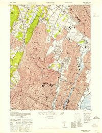
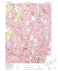
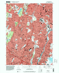
Historical Maps of Ampere Through Time
4 maps found