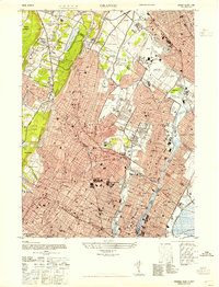
1947 Map of Orange
USGS Topo · Published 1947About this map
Orange Mountain and the First Watchung Mountain anchor the western edge of this dense metropolitan landscape during the post-war era. The transition from industrial corridors to early suburban expansion is evident in the tightly packed street grids of Newark, Bloomfield, and East Orange, contrasted with the larger institutional tracts and recreational spaces to the west. Significant local infrastructure of the period is prominent, including the Caldwell-Wright Airport and massive public works like the Cedar Grove Reservoir.
Find a feature on this map
73 named features on this map. Tap any name to fly to it.
Don’t see what you’re looking for? This feature index may not catch every label — zoom into the map to look around manually.
Map Details
Editions of this 1947 Orange Map
This is the sole edition of this map. No revisions or reprints were ever made.
Other maps of this area

1888 · Plainfield
USGS Topo · 1:62,500

1888 · Morristown
USGS Topo · 1:62,500

1888 · Paterson
USGS Topo · 1:62,500

1892 · Paterson
USGS Topo · 1:62,500

1893 · Plainfield
USGS Topo · 1:62,500

1894 · Morristown
USGS Topo · 1:62,500

1898 · Morristown
USGS Topo · 1:62,500

1898 · Plainfield
USGS Topo · 1:62,500

1898 · Staten Island
USGS Topo · 1:62,500

1898 · Paterson
USGS Topo · 1:62,500