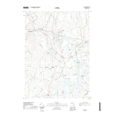
2021 Map of Orange
USGS Topo · Published 2021About this map
Millers River cuts a prominent path through the town of Orange, serving as a central artery for the surrounding hills and industrial sites. The landscape is characterized by a series of high points like Fall Hill and Fishers Hill, which frame the residential and commercial corridors. To the south, the massive footprint of the Quabbin Reservoir dominates the terrain, marking the boundary where earlier settlements gave way to the water supply needs of the region.
Find a feature on this map
170 named features on this map. Tap any name to fly to it.
Don’t see what you’re looking for? This feature index may not catch every label — zoom into the map to look around manually.
Map Details
Editions of this 2021 Orange Map
This is the sole edition of this map. No revisions or reprints were ever made.
Other maps of this area

1887 · Warwick
USGS Topo · 1:62,500

1887 · Belchertown
USGS Topo · 1:62,500

1887 · Winchendon
USGS Topo · 1:62,500

1887 · Barre
USGS Topo · 1:62,500

1889 · Barre
USGS Topo · 1:62,500

1889 · Warwick
USGS Topo · 1:62,500

1890 · Belchertown
USGS Topo · 1:62,500

1890 · Winchendon
USGS Topo · 1:62,500

1893 · Belchertown
USGS Topo · 1:62,500

1894 · Winchendon
USGS Topo · 1:62,500