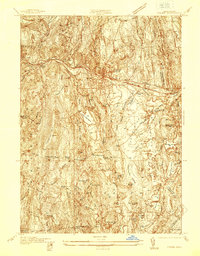
1937 Map of Orange
USGS Topo · Published 1937About this map
The Millers River valley serves as the industrial and transportation backbone of this 1937 landscape, where the Boston and Maine Railroad and the Mohawk State Highway parallel the water through Orange and West Orange. The map reveals a distinct division between the concentrated development of the river corridor and the upland settlements to the south, such as Morse Village and North New Salem. These higher elevations are characterized by scattered educational and community landmarks like the Morse Village Sch and Browns Fay Sch.
Find a feature on this map
48 named features on this map. Tap any name to fly to it.
Don’t see what you’re looking for? This feature index may not catch every label — zoom into the map to look around manually.
Map Details
Editions of this 1937 Orange Map
This is the sole edition of this map. No revisions or reprints were ever made.
Other maps of this area

1887 · Warwick
USGS Topo · 1:62,500

1887 · Belchertown
USGS Topo · 1:62,500

1887 · Winchendon
USGS Topo · 1:62,500

1887 · Barre
USGS Topo · 1:62,500

1889 · Barre
USGS Topo · 1:62,500

1889 · Warwick
USGS Topo · 1:62,500

1890 · Belchertown
USGS Topo · 1:62,500

1890 · Winchendon
USGS Topo · 1:62,500

1893 · Belchertown
USGS Topo · 1:62,500

1894 · Winchendon
USGS Topo · 1:62,500