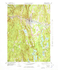
1977 Map of Orange
USGS Topo · Published 1978About this map
The Millers River corridor serves as the primary industrial and transport artery for the northern section of this survey, where the Boston and Maine Railroad connects the town of Orange with the small rail-side hamlet at Wendell Depot. This mid-1970s landscape reveals a mix of dense forest reserves and early-century industrial infrastructure, anchored by the vast Quabbin Reservoir watershed to the south. The topographic detail preserves several legacy settlements and rural centers, including Morse Village and North New Salem, while also documenting the growth of municipal aviation at the Orange Municipal Airport. Family history researchers can locate specific local landmarks such as Jones Cem and the Village Ch, alongside natural features like the distinctive The Bears Den rock formation and the elevated ridges of North Pond Ridge.
Find a feature on this map
68 named features on this map. Tap any name to fly to it.
Don’t see what you’re looking for? This feature index may not catch every label — zoom into the map to look around manually.
Map Details
Editions of this 1977 Orange Map
This is the sole edition of this map. No revisions or reprints were ever made.
Other maps of this area

1887 · Warwick
USGS Topo · 1:62,500

1887 · Belchertown
USGS Topo · 1:62,500

1887 · Winchendon
USGS Topo · 1:62,500

1887 · Barre
USGS Topo · 1:62,500

1889 · Barre
USGS Topo · 1:62,500

1889 · Warwick
USGS Topo · 1:62,500

1890 · Belchertown
USGS Topo · 1:62,500

1890 · Winchendon
USGS Topo · 1:62,500

1893 · Belchertown
USGS Topo · 1:62,500

1894 · Winchendon
USGS Topo · 1:62,500