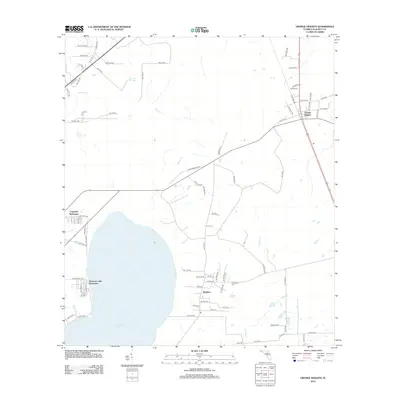
2012 Map of Orange Heights
USGS Topo · Published 2012About this map
Newnans Lake dominates the southwestern quadrant of this Alachua County landscape, providing a natural focal point for the surrounding residential developments and rural outposts. The settlement patterns reflect a mix of established community centers and newer residential clusters, with the Newnans Lake Homesites and Copeland Settlement hugging the shoreline. To the east, the village of Windsor serves as a central hub, while Orange Heights sits to the north near the junction of major transit corridors.
Find a feature on this map
74 named features on this map. Tap any name to fly to it.
Don’t see what you’re looking for? This feature index may not catch every label — zoom into the map to look around manually.
Map Details
Editions of this 2012 Orange Heights Map
This is the sole edition of this map. No revisions or reprints were ever made.
Other maps of this area

1890 · Arredondo
USGS Topo · 1:62,500

1892 · Arredondo
USGS Topo · 1:62,500

1894 · Arredondo
USGS Topo · 1:62,500

1938 · Hawthorn
USGS Topo · 1:48,000

1941 · Starke
USGS Topo · 1:62,500

1943 · Hawthorn
USGS Topo · 1:62,500

1948 · Starke
USGS Topo · 1:50,000

1949 · Waldo
USGS Topo · 1:24,000
1949 · Keystone Heights
USGS Topo · 1:24,000

1949 · Starke
USGS Topo · 1:62,500