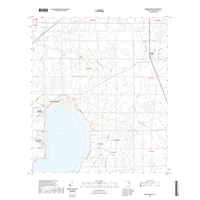
2021 Map of Orange Heights
USGS Topo · Published 2021About this map
Newnans Lake and the wetlands of the Gum Root Swamp dominate this part of Alachua County, where residential pockets and conservation lands meet. Small communities like Windsor, Orange Heights, and the Copeland Settlement reflect a pattern of rural habitation and localized expansion on the periphery of Gainesville. The map captures a high density of cemetery and church sites essential for genealogical research, including the Providence United Methodist Church Cem and the Hatchet Creek / Pons Cem.
Find a feature on this map
79 named features on this map. Tap any name to fly to it.
Don’t see what you’re looking for? This feature index may not catch every label — zoom into the map to look around manually.
Map Details
Editions of this 2021 Orange Heights Map
This is the sole edition of this map. No revisions or reprints were ever made.
Other maps of this area

1890 · Arredondo
USGS Topo · 1:62,500

1892 · Arredondo
USGS Topo · 1:62,500

1894 · Arredondo
USGS Topo · 1:62,500

1938 · Hawthorn
USGS Topo · 1:48,000

1941 · Starke
USGS Topo · 1:62,500

1943 · Hawthorn
USGS Topo · 1:62,500

1948 · Starke
USGS Topo · 1:50,000

1949 · Waldo
USGS Topo · 1:24,000
1949 · Keystone Heights
USGS Topo · 1:24,000

1949 · Starke
USGS Topo · 1:62,500