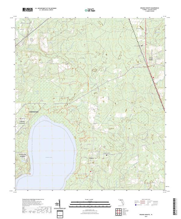
2024 Map of Orange Heights
USGS Topo · Published 2024About this map
Newnans Lake and the vast Gum Root Swamp dominate this landscape northeast of Gainesville, where water shapes the pattern of settlement and recreation. Along the eastern shore, the Potano Paddling Trail skirts the edge of the Newnans Lake Conservation Area, providing a look at the preserved wetlands that define Alachua County's interior. Small residential clusters like Newnans Lake Homesites and the Copeland Settlement sit near the city's edge, while more established rural communities lie further east.
Find a feature on this map
76 named features on this map. Tap any name to fly to it.
Don’t see what you’re looking for? This feature index may not catch every label — zoom into the map to look around manually.
Map Details
Editions of this 2024 Orange Heights Map
This is the sole edition of this map. No revisions or reprints were ever made.
Other maps of this area

1890 · Arredondo
USGS Topo · 1:62,500

1892 · Arredondo
USGS Topo · 1:62,500

1894 · Arredondo
USGS Topo · 1:62,500

1938 · Hawthorn
USGS Topo · 1:48,000

1941 · Starke
USGS Topo · 1:62,500

1943 · Hawthorn
USGS Topo · 1:62,500

1948 · Starke
USGS Topo · 1:50,000

1949 · Waldo
USGS Topo · 1:24,000
1949 · Keystone Heights
USGS Topo · 1:24,000

1949 · Starke
USGS Topo · 1:62,500