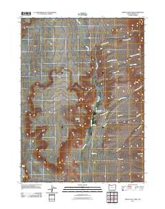
2011 Map of Oregon End Table
USGS Topo · Published 2011About this map
Oregon End Table rises above the high desert of Harney County, defining a landscape shaped by seasonal watercourses and remote ranching operations. The area is anchored by the Oregon End Ranch, situated along the winding path of Rincon Creek. This modern survey illustrates the critical role of water management in a desert environment, evidenced by the Oregon End Reservoir and scattered water sources like Indian Spring. The terrain is deeply incised by numerous drainages, including Rough Canyon Creek, Modesto Creek, and Stonehouse Creek, which all feed into the larger hydrological network of the basin. The map reveals the isolation of these high-plateau operations, where a single road network connects the ranch to the wider region, and the land is divided by named geographical features such as Rough Canyon and Five Draws.
Find a feature on this map
14 named features on this map. Tap any name to fly to it.
Don’t see what you’re looking for? This feature index may not catch every label — zoom into the map to look around manually.
Map Details
Editions of this 2011 Oregon End Table Map
This is the sole edition of this map. No revisions or reprints were ever made.
Other maps of this area

1886 · Disaster
USGS Topo · 1:250,000

1893 · Disaster
USGS Topo · 1:250,000

1954 · Vya
USGS Topo · 1:250,000

1955 · Adel
USGS Topo · 1:250,000

1957 · Adel
USGS Topo · 1:250,000

1958 · Vya
USGS Topo · 1:250,000

1958 · Adel
USGS Topo · 1:250,000

1962 · Vya
USGS Topo · 1:250,000

1962 · Adel
USGS Topo · 1:250,000
1965 · Railroad Point
USGS Topo · 1:62,500