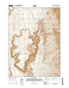
2014 Map of Oregon End Table
USGS Topo · Published 2014About this map
Oregon End Table rises as a prominent landmark in this high-desert portion of Harney County, characterized by a complex network of seasonal drainages and isolated water sources. This 2014 survey by the U.S. Geological Survey illustrates a remote landscape where water management and natural springs are vital to the local geography. The Oregon End Reservoir sits near the base of the table, capturing runoff from Stonehouse Cr and Rincon Cr. The terrain is deeply incised by erosion, most notably at Rough Canyon and Long Draw, while Indian Spring provides a rare perennial water point in the southern reaches. This map is particularly valuable for understanding the Public Land Survey System divisions in the region, clearly marking the boundaries of t40s r33e and its neighboring townships.
Find a feature on this map
17 named features on this map. Tap any name to fly to it.
Don’t see what you’re looking for? This feature index may not catch every label — zoom into the map to look around manually.
Map Details
Editions of this 2014 Oregon End Table Map
This is the sole edition of this map. No revisions or reprints were ever made.
Other maps of this area

1886 · Disaster
USGS Topo · 1:250,000

1893 · Disaster
USGS Topo · 1:250,000

1954 · Vya
USGS Topo · 1:250,000

1955 · Adel
USGS Topo · 1:250,000

1957 · Adel
USGS Topo · 1:250,000

1958 · Vya
USGS Topo · 1:250,000

1958 · Adel
USGS Topo · 1:250,000

1962 · Vya
USGS Topo · 1:250,000

1962 · Adel
USGS Topo · 1:250,000
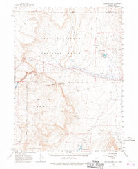
1965 · Railroad Point
USGS Topo · 1:62,500