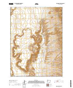
2020 Map of Oregon End Table
USGS Topo · Published 2020About this map
Oregon End Table rises as a prominent plateau in the high desert of Harney County, characterized by a complex system of seasonal drainage and isolated water sources. This 2020 survey documents a landscape where ranching infrastructure and remote access routes are the primary human imprints. The Oregon End Reservoir sits near the center of the sheet, collecting runoff from Rincon Cr and Stonehouse Cr. In the southwest corner, Indian Spring and the Long Draw provide critical water points in an otherwise arid environment. Travel through this portion of the Great Basin is defined by the Fields-Denio Rd and the Oregon End Table Rd, which trace the natural contours of the basin floor. The map also details numerous named canyons, including Rough Canyon and its associated Rough Canyon Creek in the northeast.
Find a feature on this map
19 named features on this map. Tap any name to fly to it.
Don’t see what you’re looking for? This feature index may not catch every label — zoom into the map to look around manually.
Map Details
Editions of this 2020 Oregon End Table Map
This is the sole edition of this map. No revisions or reprints were ever made.
Other maps of this area

1886 · Disaster
USGS Topo · 1:250,000

1893 · Disaster
USGS Topo · 1:250,000

1954 · Vya
USGS Topo · 1:250,000

1955 · Adel
USGS Topo · 1:250,000

1957 · Adel
USGS Topo · 1:250,000

1958 · Vya
USGS Topo · 1:250,000

1958 · Adel
USGS Topo · 1:250,000

1962 · Vya
USGS Topo · 1:250,000

1962 · Adel
USGS Topo · 1:250,000
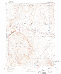
1965 · Railroad Point
USGS Topo · 1:62,500