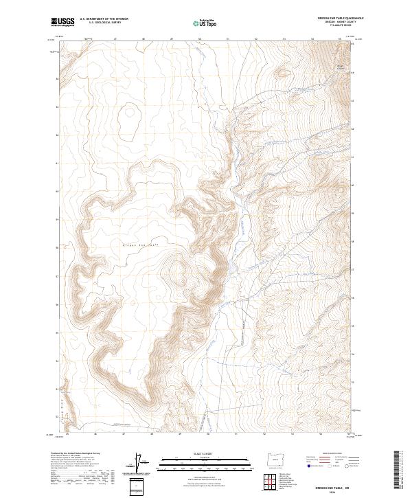
2024 Map of Oregon End Table
USGS Topo · Published 2024About this map
Oregon End Table rises as a prominent high-plateau landform in the arid landscape of Harney County, defining the western portion of this high-desert survey. This 2024 map documents a rugged drainage network where ephemeral waterways like Rough Canyon Creek and Five Draws Creek carve through steep topography toward the east. The primary hydrological artery, Rincon Creek, flows southward through the center of the quadrangle, flanked by seasonal tributaries such as Stonehouse Creek and East Creek. Modern transportation is represented by Oregon End Table Rd and the Fields-Denio-Rd Rincon Dr, which provide rare access points through this isolated terrain. For the researcher, the map preserves the location of Indian Spring and the distinctive geological features of Rough Canyon and Long Draw, providing a precise look at the land's character in the early 21st century.
Find a feature on this map
18 named features on this map. Tap any name to fly to it.
Don’t see what you’re looking for? This feature index may not catch every label — zoom into the map to look around manually.
Map Details
Editions of this 2024 Oregon End Table Map
This is the sole edition of this map. No revisions or reprints were ever made.
Other maps of this area

1886 · Disaster
USGS Topo · 1:250,000

1893 · Disaster
USGS Topo · 1:250,000

1954 · Vya
USGS Topo · 1:250,000

1955 · Adel
USGS Topo · 1:250,000

1957 · Adel
USGS Topo · 1:250,000

1958 · Vya
USGS Topo · 1:250,000

1958 · Adel
USGS Topo · 1:250,000

1962 · Vya
USGS Topo · 1:250,000

1962 · Adel
USGS Topo · 1:250,000

1965 · Railroad Point
USGS Topo · 1:62,500