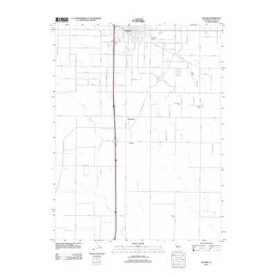
2012 Map of Orland
USGS Topo · Published 2012About this map
Orland serves as the primary hub in this northern California agricultural landscape, situated at the intersection of a dense grid of county roads. The town's civic character is defined by the Glenn County Fairground and the local Po, while the surrounding plains are marked by small settlements like Greenwood and Grapit. This area is heavily defined by its water management systems, specifically the prominent Tehama Colusa Canal which traverses the terrain alongside natural drainage like Walker Cr and S Fork Walker Cr. Genealogists and local historians will find significant value in the mapped locations of several burial grounds, including the Oddfellows Cem, Catholic Cem, and Artois Cem, which provide a geographic anchor for the region's historic family lineages. Aviation history is also represented by Haigh Field east of the main Interstate corridor.
Find a feature on this map
61 named features on this map. Tap any name to fly to it.
Don’t see what you’re looking for? This feature index may not catch every label — zoom into the map to look around manually.
Map Details
Editions of this 2012 Orland Map
This is the sole edition of this map. No revisions or reprints were ever made.
Other maps of this area

1904 · Vina
USGS Topo · 1:62,500

1904 · Walker Creek
USGS Topo · 1:31,680

1906 · Willows
USGS Topo · 1:62,500

1914 · Kirkwood
USGS Topo · 1:31,680

1914 · Orland
USGS Topo · 1:31,680

1914 · Hamilton
USGS Topo · 1:31,680

1914 · McIntosh Landing
USGS Topo · 1:31,680

1917 · Kurand
USGS Topo · 1:31,680

1917 · Lyman
USGS Topo · 1:31,680

1917 · Jacinto
USGS Topo · 1:31,680