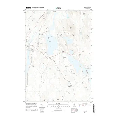
2014 Map of Orland
USGS Topo · Published 2014About this map
Alamoosook Lake and the branching waters of Toddy Pond anchor this coastal Maine landscape, where the Narramissic River flows through the historic village of Orland. The topography is defined by significant granite elevations such as Great Pond Mtn and Dressers Mtn, framing a complex network of ponds including Craig Pond and Hothole Pond. Settled communities are concentrated along the Acadia Hwy, with small hamlets at Five Mile Corners and East Orland showing the persistent rural development patterns of Hancock County.
Find a feature on this map
118 named features on this map. Tap any name to fly to it.
Don’t see what you’re looking for? This feature index may not catch every label — zoom into the map to look around manually.
Map Details
Editions of this 2014 Orland Map
This is the sole edition of this map. No revisions or reprints were ever made.
Other maps of this area

1900 · Orland
USGS Topo · 1:62,500

1900 · Bucksport
USGS Topo · 1:62,500

1902 · Bucksport
USGS Topo · 1:62,500

1902 · Castine
USGS Topo · 1:62,500

1904 · Castine
USGS Topo · 1:62,500

1904 · Bluehill
USGS Topo · 1:62,500

1905 · Penobscot Bay
USGS Topo · 1:125,000

1941 · Castine
USGS Topo · 1:62,500

1942 · Orland
USGS Topo · 1:62,500

1942 · Bucksport
USGS Topo · 1:62,500