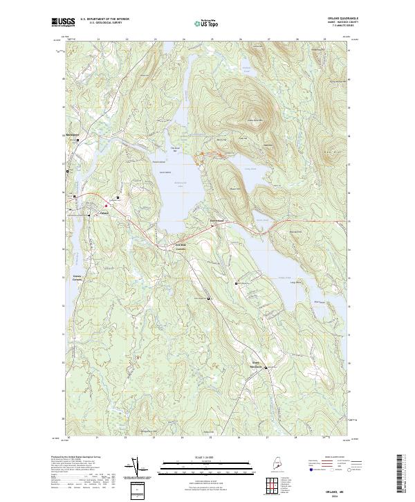
2024 Map of Orland
USGS Topo · Published 2024About this map
Alamoosook Lake and the Narramissic River anchor a landscape defined by glacial waters and coastal hills in Hancock County. The area’s historic role in conservation is highlighted by the Craig Brook National Fish Hatchery, situated between Craig Pond and the river valley. The settlement pattern follows old transit points like Five Mile Corners and Cranes Corners, where small crossroads provided essential hubs for the rural population. Genealogists will find a wealth of burial grounds preserved on this sheet, from the Evergreen Cem near the town of Orland to the Hillside Cem further south in North Penobscot. The terrain rises sharply to peaks like Great Pond Mtn and Flying Moose Mtn, contrasting with the low-lying bog of the Great Heath in the southern reaches of the quadrangle.
Find a feature on this map
120 named features on this map. Tap any name to fly to it.
Don’t see what you’re looking for? This feature index may not catch every label — zoom into the map to look around manually.
Map Details
Editions of this 2024 Orland Map
This is the sole edition of this map. No revisions or reprints were ever made.
Other maps of this area

1900 · Orland
USGS Topo · 1:62,500

1900 · Bucksport
USGS Topo · 1:62,500

1902 · Bucksport
USGS Topo · 1:62,500

1902 · Castine
USGS Topo · 1:62,500

1904 · Castine
USGS Topo · 1:62,500

1904 · Bluehill
USGS Topo · 1:62,500

1905 · Penobscot Bay
USGS Topo · 1:125,000

1941 · Castine
USGS Topo · 1:62,500

1942 · Orland
USGS Topo · 1:62,500

1942 · Bucksport
USGS Topo · 1:62,500