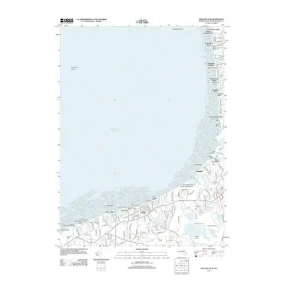
2012 Map of Orleans OE W
USGS Topo · Published 2012About this map
East Brewster and the surrounding coastal landscape of Barnstable County are meticulously documented in this 2012 survey. The interior is defined by a dense concentration of kettle ponds, including Cliff Pond, Higgins Pond, and Flax Pond, which illustrate the post-glacial topography of the Cape. Local heritage is grounded in landmarks like the Old Higgins Windmill and the Foster Cem, while the northern coastline features a series of public landings such as Ellis Landing and Point of Rocks Landing. The map captures the specialized land use of the era, from the Youth Forestry Camp tucked between the ponds to the coastal attraction Sealand of Cape Cod near Quivett Neck. Along the bay, the expanse of Billingsgate Shoal and the designated waters of Rock Harbor signify the enduring maritime importance of these tidal flats and inlets.
Find a feature on this map
152 named features on this map. Tap any name to fly to it.
Don’t see what you’re looking for? This feature index may not catch every label — zoom into the map to look around manually.
Map Details
Editions of this 2012 Orleans OE W Map
This is the sole edition of this map. No revisions or reprints were ever made.
Other maps of this area

1887 · Wellfleet
USGS Topo · 1:62,500

1887 · Yarmouth
USGS Topo · 1:62,500

1888 · Chatham
USGS Topo · 1:62,500

1889 · Yarmouth
USGS Topo · 1:62,500

1889 · Wellfleet
USGS Topo · 1:62,500

1893 · Chatham
USGS Topo · 1:62,500

1893 · Yarmouth
USGS Topo · 1:62,500

1893 · Wellfleet
USGS Topo · 1:62,500

1917 · Chatham
USGS Topo · 1:62,500

1942 · Cape Cod Bay
USGS Topo · 1:125,000