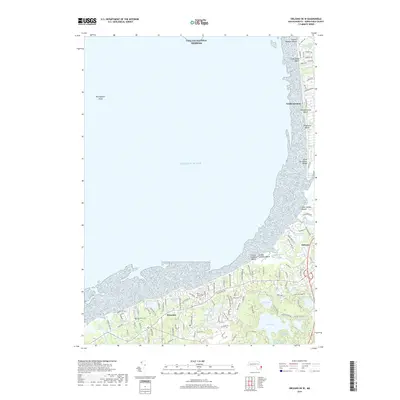
2018 Map of Orleans OE W
USGS Topo · Published 2018About this map
Brewster and Orleans anchor the southern reaches of this Cape Cod study, where the landscape is defined by an intricate network of kettle ponds and salt marshes. The interior is dotted with significant local landmarks like Schoolhouse Pond, Cliff Pond, and Flax Pond, while the cultural history of the area is preserved at sites like Brewster Cem and Pine Grove Cem. Along the western shoreline, the sprawling Cape Cod National Seashore protects a series of coastal environments, from the Billingsgate Shoal to the extensive Little Namskaket River Marshes. The residential development follows old paths like Rock Harbor Rd and Samoset Rd, illustrating the modern layout of these maritime communities. Further north, North Eastham sits adjacent to the iconic First Encounter Beach, a coastline shaped by the Atlantic Ocean and numerous small inlets such as Namskaket Creek.
Find a feature on this map
115 named features on this map. Tap any name to fly to it.
Don’t see what you’re looking for? This feature index may not catch every label — zoom into the map to look around manually.
Map Details
Editions of this 2018 Orleans OE W Map
This is the sole edition of this map. No revisions or reprints were ever made.
Other maps of this area

1887 · Wellfleet
USGS Topo · 1:62,500

1887 · Yarmouth
USGS Topo · 1:62,500

1888 · Chatham
USGS Topo · 1:62,500

1889 · Yarmouth
USGS Topo · 1:62,500

1889 · Wellfleet
USGS Topo · 1:62,500

1893 · Chatham
USGS Topo · 1:62,500

1893 · Yarmouth
USGS Topo · 1:62,500

1893 · Wellfleet
USGS Topo · 1:62,500

1917 · Chatham
USGS Topo · 1:62,500

1942 · Cape Cod Bay
USGS Topo · 1:125,000