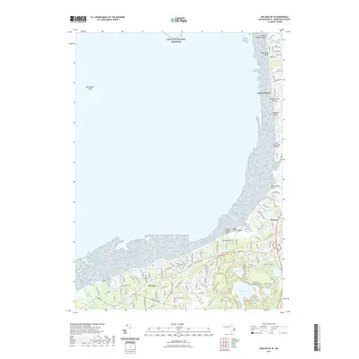
2021 Map of Orleans OE W
USGS Topo · Published 2021About this map
Cape Cod National Seashore dominates the northern shoreline of this coastal survey, where the Atlantic interface is defined by a series of beach landings and expansive wetland systems. From Sunken Meadow Beach down to First Encounter Beach, the map details a landscape of shifting sands and tidal influence, including the Boat Meadow River Marshes. Inland, the terrain is pocketed with numerous kettle ponds such as Cliff Pond, Flax Pond, and Salls Pond, which characterize the glacial geography of the region. The legacy of local infrastructure is evident in the Cape Cod Rail Trl, which threads through the settlements of Brewster and Orleans. Genealogists may find value in the locations of the Brewster Cem and Pine Grove Cem, while maritime researchers can note the offshore positioning of Billingsgate Shoal.
Find a feature on this map
123 named features on this map. Tap any name to fly to it.
Don’t see what you’re looking for? This feature index may not catch every label — zoom into the map to look around manually.
Map Details
Editions of this 2021 Orleans OE W Map
This is the sole edition of this map. No revisions or reprints were ever made.
Other maps of this area

1887 · Wellfleet
USGS Topo · 1:62,500

1887 · Yarmouth
USGS Topo · 1:62,500

1888 · Chatham
USGS Topo · 1:62,500

1889 · Yarmouth
USGS Topo · 1:62,500

1889 · Wellfleet
USGS Topo · 1:62,500

1893 · Chatham
USGS Topo · 1:62,500

1893 · Yarmouth
USGS Topo · 1:62,500

1893 · Wellfleet
USGS Topo · 1:62,500

1917 · Chatham
USGS Topo · 1:62,500

1942 · Cape Cod Bay
USGS Topo · 1:125,000