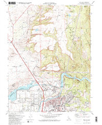
1970 Map of Oroville
USGS Topo · Published 1984About this map
The industrial and water management infrastructure of the Feather River corridor dominates this 1970 study of Butte County. Significant landscape modifications are visible, including the Thermalito Forebay and the Thermalito Power Canal, which redirected regional water flow for power and irrigation. Along the river, the Feather River Fish Hatchery and Powerhouse stand as key landmarks of the era's utility development. To the north, the dramatic plateau of North Table Mountain rises above a landscape cut by Coal Canyon and Beatson Creek.
Find a feature on this map
68 named features on this map. Tap any name to fly to it.
Don’t see what you’re looking for? This feature index may not catch every label — zoom into the map to look around manually.
Map Details
Editions of this 1970 Oroville Map
2 editions found
Other maps of this area

1888 · Marysville
USGS Topo · 1:125,000

1888 · Smartsville
USGS Topo · 1:125,000

1888 · Bidwell Bar
USGS Topo · 1:125,000

1891 · Bidwell Bar
USGS Topo · 1:125,000

1891 · Chico
USGS Topo · 1:125,000

1891 · Marysville
USGS Topo · 1:125,000

1891 · Smartsville
USGS Topo · 1:125,000

1892 · Smartsville
USGS Topo · 1:125,000

1893 · Chico
USGS Topo · 1:125,000

1893 · Bidwell Bar
USGS Topo · 1:125,000