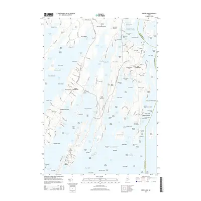
2014 Map of Orrs Island
USGS Topo · Published 2014About this map
The complex coastline of Casco Bay defines this maritime landscape, where the long, linear peninsulas and islands of Maine’s mid-coast reach into the Atlantic. At Orrs Island, the local geography is shaped by narrow inlets like Reed Cove and Gun Point Cove, while the village of Cundys Harbor marks a historic fishing and seafaring hub on the eastern edge. The map captures the transition from the rail-accessible Brunswick Station in the north to the isolated island communities to the south, connected by the Gurnet Bridge.
Find a feature on this map
245 named features on this map. Tap any name to fly to it.
Don’t see what you’re looking for? This feature index may not catch every label — zoom into the map to look around manually.
Map Details
Editions of this 2014 Orrs Island Map
This is the sole edition of this map. No revisions or reprints were ever made.
Other maps of this area

1892 · Freeport
USGS Topo · 1:62,500

1893 · Small Point
USGS Topo · 1:62,500

1893 · Casco Bay
USGS Topo · 1:62,500

1894 · Bath
USGS Topo · 1:62,500

1914 · Casco Bay
USGS Topo · 1:48,000

1916 · Casco Bay
USGS Topo · 1:62,500

1916 · Portland And Vicinity
USGS Topo · 1:62,500

1918 · Portland And Vicinity
USGS Topo · 1:62,500

1919 · Small Point
USGS Topo · 1:62,500

1920 · Bath
USGS Topo · 1:62,500