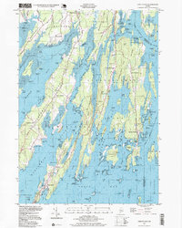
1997 Map of Orrs Island
USGS Topo · Published 1999About this map
Sebascodegan Island and Orrs Island define this coastal reach of Casco Bay, where the complex network of tidal inlets and fingers of land reveals the maritime character of the Maine coast. Small fishing villages and residential clusters like Cundys Harbor and Harpswell Center are connected by winding corridors like Harpswell Road, while larger institutions such as the U S Naval Air Station occupy the northern flatlands near Brunswick. The intricate coastline is dotted with smaller features of local historical interest, including the Union Ch, the Queen of the Mission Chapel, and the Cranberryhorn Cem. Numerous islands, from the significant Yarmouth Island to the smaller Bombazine Island, separate deep water passages like Harpswell Sound and Merriconeag Sound, illustrating a landscape shaped by both the sea and the quiet expansion of these coastal communities through the late twentieth century.
Find a feature on this map
154 named features on this map. Tap any name to fly to it.
Don’t see what you’re looking for? This feature index may not catch every label — zoom into the map to look around manually.
Map Details
Editions of this 1997 Orrs Island Map
This is the sole edition of this map. No revisions or reprints were ever made.
Other maps of this area

1892 · Freeport
USGS Topo · 1:62,500

1893 · Small Point
USGS Topo · 1:62,500

1893 · Casco Bay
USGS Topo · 1:62,500

1894 · Bath
USGS Topo · 1:62,500

1914 · Casco Bay
USGS Topo · 1:48,000

1916 · Casco Bay
USGS Topo · 1:62,500

1916 · Portland And Vicinity
USGS Topo · 1:62,500

1918 · Portland And Vicinity
USGS Topo · 1:62,500

1919 · Small Point
USGS Topo · 1:62,500

1920 · Bath
USGS Topo · 1:62,500