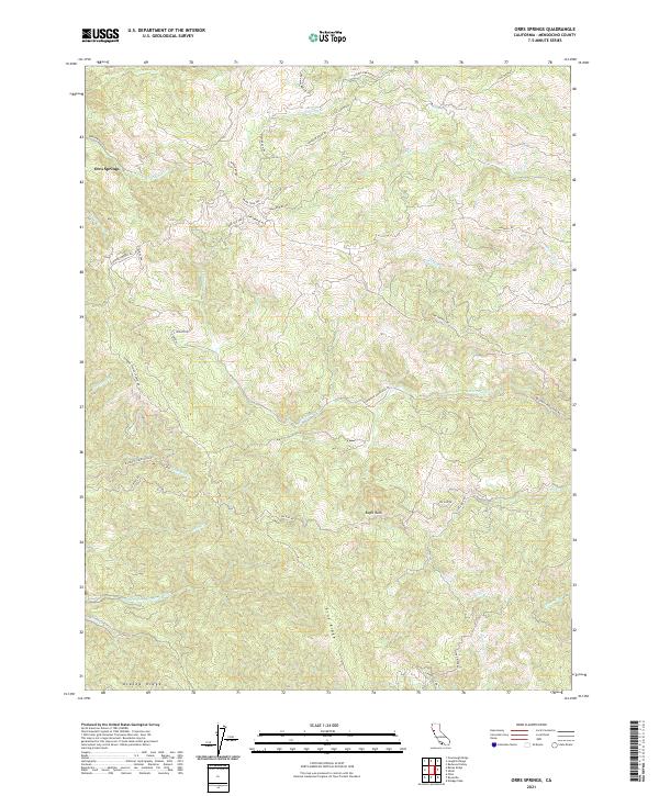
2021 Map of Orrs Springs
USGS Topo · Published 2021About this map
Orrs Springs serves as the focal point for this survey of the Mendocino interior, where the headwaters of several major California watersheds converge. The landscape is defined by its deep drainage networks, including the S Fork Big River and the S Br N Fork Navarro River, which carve through the prominent topography of Pine Ridge and Alaska Ridge. This era of the region's development is marked by a complex network of ranch and timber access roads, such as Masonite Industrial RD and Running Springs Ranch Rd, tracing the ridgelines and creek beds. The cartography reveals a transition from the steeper canyons near Eagle Rock to the lower elevation crossings of Ackerman Cr and Orrs Cr. Notable for local history researchers are the numerous private named roads like Fred Macmurray Ln and Brandywine Dr, which indicate the evolving residential and commercial footprint in these remote hills.
Find a feature on this map
44 named features on this map. Tap any name to fly to it.
Don’t see what you’re looking for? This feature index may not catch every label — zoom into the map to look around manually.
Map Details
Editions of this 2021 Orrs Springs Map
This is the sole edition of this map. No revisions or reprints were ever made.
Other maps of this area

1920 · Ukiah
USGS Topo · 1:62,500

1922 · Willits
USGS Topo · 1:62,500

1942 · Willits
USGS Topo · 1:62,500

1943 · Pomo
USGS Topo · 1:62,500

1943 · Boonville
USGS Topo · 1:62,500

1944 · Ukiah
USGS Topo · 1:62,500

1944 · Willits
USGS Topo · 1:62,500

1957 · Ukiah
USGS Topo · 1:250,000

1958 · Ukiah
USGS Topo · 1:24,000
1958 · Elledge Peak
USGS Topo · 1:24,000