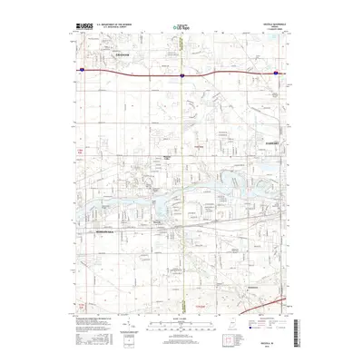
2016 Map of Osceola
USGS Topo · Published 2016About this map
The Saint Joseph River serves as the central geographic corridor for this 2016 survey, winding through the heart of northern Indiana's developed landscape between Mishawaka and Elkhart. The town of Osceola is positioned at the confluence of Baugo Creek and the river, marking a point of transition between the dense urban clusters and the surrounding residential expansions. Notable aviation landmarks are represented by the Elkhart Municipal Airport to the northeast and the Mishawaka Pilots Club Airport further south. For genealogists, the map identifies several significant burial sites, including the Noffsinger Cem and the extensive Chapel Hill Memorial Gardens. The drainage network, featuring Judy Cr and Cobus Cr, illustrates the hydrological connection between the northern plateau near Granger and the river valley below.
Find a feature on this map
223 named features on this map. Tap any name to fly to it.
Don’t see what you’re looking for? This feature index may not catch every label — zoom into the map to look around manually.
Map Details
Editions of this 2016 Osceola Map
This is the sole edition of this map. No revisions or reprints were ever made.
Other maps of this area

1945 · Cassopolis
USGS Topo · 1:62,500

1947 · Cassopolis
USGS Topo · 1:62,500

1948 · Vandalia
USGS Topo · 1:62,500

1949 · Vandalia
USGS Topo · 1:62,500

1953 · Fort Wayne
USGS Topo · 1:250,000

1953 · Chicago
USGS Topo · 1:250,000

1956 · Fort Wayne
USGS Topo · 1:250,000

1957 · Chicago
USGS Topo · 1:250,000

1958 · South Bend East
USGS Topo · 1:24,000

1958 · Osceola
USGS Topo · 1:24,000