2021 Map of Osino
USGS Topo · Published 2021About this map
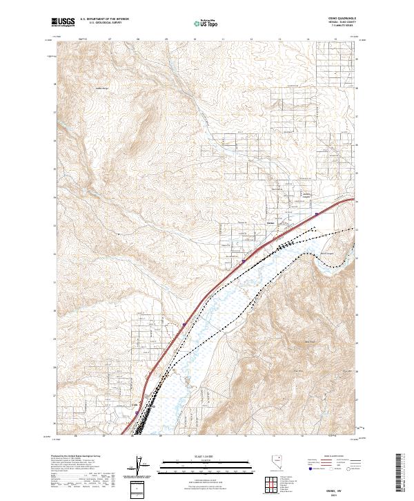
The Humboldt River corridor serves as the primary artery through this Nevada landscape, guiding both water and transport through the high desert. To the north, the Adobe Range dominates the horizon, with seasonal drainages like Jackstone Cr and Sherman Cr cutting south toward the valley floor. The settlement of Osino sits at a strategic junction near Osino Canyon, where the modern infrastructure of Victory Blvd and Old Hwy 40 follows the historical path of least resistance through the hills.
Find a feature on this map
66 named features on this map. Tap any name to fly to it.
Don’t see what you’re looking for? This feature index may not catch every label — zoom into the map to look around manually.
Map Details
Editions of this 2021 Osino Map
This is the sole edition of this map. No revisions or reprints were ever made.