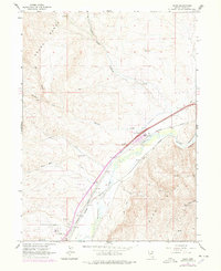
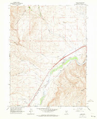
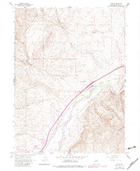
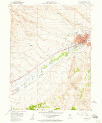
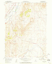
1962 Map of Osino
USGS Topo · Published 1978About this map
The Humboldt River cuts a vital corridor through Elko County, flanked by the Adobe Range to the northwest and the Elko Hills to the southeast. This 1962 topographic survey, updated with revisions from 1975, documents a landscape where traditional ranching landmarks like Stock Pass and Sheep Creek Well coexist with modern transportation and communication infrastructure. The small settlement of Osino serves as a focal point near the Osino Interchange of Interstate 80, while the Southern Pacific and Western Pacific railroads parallel the river's winding path through the canyon.
Find a feature on this map
29 named features on this map. Tap any name to fly to it.
Don’t see what you’re looking for? This feature index may not catch every label — zoom into the map to look around manually.
Map Details
Editions of this 1962 Osino Map
Other maps of this area

1955 · Wells
USGS Topo · 1:250,000

1955 · Elko
USGS Topo · 1:250,000
1957 · Elko West
USGS Topo · 1:24,000
1957 · Elko East
USGS Topo · 1:24,000

1958 · Wells
USGS Topo · 1:250,000

1958 · Elko
USGS Topo · 1:250,000

1961 · Wells
USGS Topo · 1:250,000

1962 · Elko
USGS Topo · 1:250,000
1962 · Kittridge Springs
USGS Topo · 1:24,000
1962 · Boyd Reservoir
USGS Topo · 1:24,000