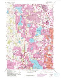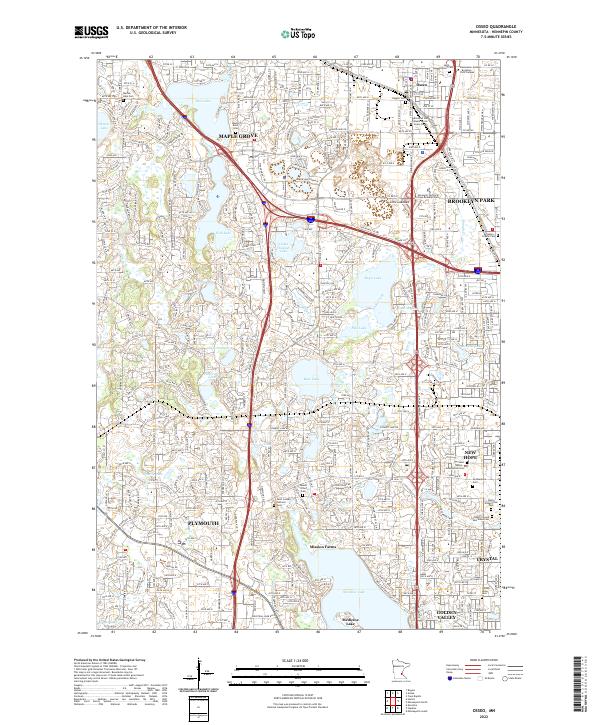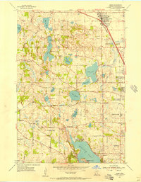
1955 Map of Osseo
USGS Topo · Published 1956About this map
Medicine Lake and a series of smaller glacial basins like Fish Lake and Bass Lake dominate this mid-century portrait of suburbanizing Hennepin County. The landscape is in transition, where established rural institutions like the Hennessy Hill Sch and St Joseph Ch meet the post-war expansion of New Hope and Brooklyn Park. The corridor of the Great Northern railroad provides a firm axis for the growing community of Osseo, while the presence of a Drive-in Theater and the expanding residential grids of Crystal signal the arrival of automobile-centric development. For genealogists, the map is particularly rich in burial sites, documenting locations such as St Vincent Cem and the Herzl Memorial Cemetery, alongside vanished country schools like the Deziel Sch and Oakwood Sch.
Find a feature on this map
43 named features on this map. Tap any name to fly to it.
Don’t see what you’re looking for? This feature index may not catch every label — zoom into the map to look around manually.
Map Details
Editions of this 1955 Osseo Map
2 editions found