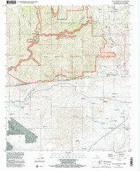
1996 Map of Otay Mountain
USGS Topo · Published 2002About this map
The San Ysidro Mountains dominate this 1996 survey, where high ridges and deep canyons meet the international border. This map offers a rare dual-nation perspective, documenting the transition from the Otay Mountain Wilderness in San Diego County to the diverse network of settlements in Baja California. In the north, the Dulzura Community Center and family-named landmarks like Donohoe Mtn and the Donohoe Mine signal the area's early mining and community roots. South of the border, the topography falls toward the Río Tijuana and the Aqueduct, where small communities such as Santa Martha, Valle Redondo, and Los Aguajitos are linked by Telegraph lines and trails. The map tracks the convergence of Cottonwood Creek and Tecate Creek in Marron Valley, a significant watershed juncture that has shaped the human geography of this borderland region for generations.
Find a feature on this map
77 named features on this map. Tap any name to fly to it.
Don’t see what you’re looking for? This feature index may not catch every label — zoom into the map to look around manually.
Map Details
Editions of this 1996 Otay Mountain Map
This is the sole edition of this map. No revisions or reprints were ever made.
Other maps of this area

1903 · Cuyamaca
USGS Topo · 1:125,000

1904 · Southern California Sheet No. 2
USGS Topo · 1:250,000

1942 · Potrero
USGS Topo · 1:48,000

1943 · Jamul
USGS Topo · 1:62,500

1944 · Potrero
USGS Topo · 1:62,500

1950 · San Diego
USGS Topo · 1:250,000

1954 · San Diego
USGS Topo · 1:250,000

1955 · San Diego
USGS Topo · 1:250,000
1955 · Jamul Mountains
USGS Topo · 1:24,000
1955 · Otay Mesa
USGS Topo · 1:24,000