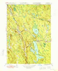
1948 Map of Otis
USGS Topo · Published 1948About this map
The expansive waters of Otis Reservoir dominate the southeastern landscape of this Berkshire County study, showcasing a complex shoreline defined by Southwest Bay, Southeast Bay, and Dismal Bay. The terrain is punctuated by significant elevations like The Pinnacle and Filley Mtn, while the Farmington River carves a path through the central valley. Small settlements such as North Otis, East Otis, and the crossroads at Algerie Four Corners serve as local hubs connected by a network of winding roads including Beech Plain Road and West Center Road. Genealogists will find historical value in the presence of several established burial grounds, including the West Center Cem, Beech Plain Cem, and Norton Cem, alongside the Beech Plain Sch, which together suggest the social and educational centers of these mid-century hill town communities.
Find a feature on this map
76 named features on this map. Tap any name to fly to it.
Don’t see what you’re looking for? This feature index may not catch every label — zoom into the map to look around manually.
Map Details
Editions of this 1948 Otis Map
2 editions found
Other maps of this area

1886 · Chesterfield
USGS Topo · 1:62,500

1886 · Becket
USGS Topo · 1:62,500

1887 · Granville
USGS Topo · 1:62,500

1888 · Becket
USGS Topo · 1:62,500

1888 · Sandisfield
USGS Topo · 1:62,500

1888 · Chesterfield
USGS Topo · 1:62,500

1889 · Granville
USGS Topo · 1:62,500

1893 · Granville
USGS Topo · 1:62,500

1893 · Chesterfield
USGS Topo · 1:62,500

1893 · Becket
USGS Topo · 1:62,500