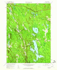
1958 Map of Otis
USGS Topo · Published 1960About this map
Otis Reservoir dominates the southeastern Berkshire landscape, its intricate shoreline defined by Southwest Bay, Southeast Bay, and Dismal Bay. This 1958 revision shows the area as a significant recreation and water resource hub, with the sprawling Otis State Forest and Tolland State Forest flanking the water bodies. The settlement pattern clusters around historical junctions like Otis, East Otis, and the uniquely named Algerie Four Corners.
Find a feature on this map
57 named features on this map. Tap any name to fly to it.
Don’t see what you’re looking for? This feature index may not catch every label — zoom into the map to look around manually.
Map Details
Editions of this 1958 Otis Map
2 editions found
Other maps of this area

1886 · Chesterfield
USGS Topo · 1:62,500

1886 · Becket
USGS Topo · 1:62,500

1887 · Granville
USGS Topo · 1:62,500

1888 · Becket
USGS Topo · 1:62,500

1888 · Sandisfield
USGS Topo · 1:62,500

1888 · Chesterfield
USGS Topo · 1:62,500

1889 · Granville
USGS Topo · 1:62,500

1893 · Granville
USGS Topo · 1:62,500

1893 · Chesterfield
USGS Topo · 1:62,500

1893 · Becket
USGS Topo · 1:62,500