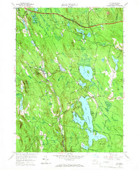
1958 Map of Otis
USGS Topo · Published 1966About this map
Otis Reservoir dominates this 1958 cultural revision, illustrating the expansive water system that defines the southern Berkshire landscape. To the north, the Massachusetts Turnpike cuts a modern path across the border of Becket, while the presence of an Old Railroad Grade and several early cemeteries, including West Center Cem and Norton Cem, trace the older transit and settlement patterns of the 19th century.
Find a feature on this map
65 named features on this map. Tap any name to fly to it.
Don’t see what you’re looking for? This feature index may not catch every label — zoom into the map to look around manually.
Map Details
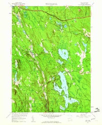
Editions of this 1958 Otis Map
2 editions found
Other maps of this area

1886 · Chesterfield
USGS Topo · 1:62,500

1886 · Becket
USGS Topo · 1:62,500

1887 · Granville
USGS Topo · 1:62,500

1888 · Becket
USGS Topo · 1:62,500

1888 · Sandisfield
USGS Topo · 1:62,500

1888 · Chesterfield
USGS Topo · 1:62,500

1889 · Granville
USGS Topo · 1:62,500

1893 · Granville
USGS Topo · 1:62,500

1893 · Chesterfield
USGS Topo · 1:62,500

1893 · Becket
USGS Topo · 1:62,500