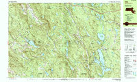
1987 Map of Otis
USGS Topo · Published 1988About this map
Beartown State Forest and Otis State Forest dominate this Berkshire County landscape, where the Appalachian Trail winds through the high ridges of Sky Hill and Baldy Mountain. The late 1980s topography reveals a region defined by its expansive water bodies, notably the Otis Reservoir and Lake Garfield, which served as central hubs for seasonal and local settlements. In the village of Monterey, the Our Lady of the Hills Chapel and Old Center Cem provide clear anchors for genealogical research, while the presence of an Art School near Lake Garfield suggests the area's evolving cultural character.
Find a feature on this map
96 named features on this map. Tap any name to fly to it.
Don’t see what you’re looking for? This feature index may not catch every label — zoom into the map to look around manually.
Map Details
Editions of this 1987 Otis Map
This is the sole edition of this map. No revisions or reprints were ever made.
Other maps of this area

1885 · Sheffield
USGS Topo · 1:62,500

1886 · Chesterfield
USGS Topo · 1:62,500

1886 · Becket
USGS Topo · 1:62,500

1887 · Granville
USGS Topo · 1:62,500

1888 · Sheffield
USGS Topo · 1:62,500

1888 · Becket
USGS Topo · 1:62,500

1888 · Sandisfield
USGS Topo · 1:62,500

1888 · Chesterfield
USGS Topo · 1:62,500

1888 · Pittsfield
USGS Topo · 1:62,500

1889 · Granville
USGS Topo · 1:62,500