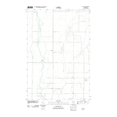
2010 Map of Oulu
USGS Topo · Published 2010About this map
The Bois Brule River snakes northward through the heart of this coastal landscape, passing McNeil Landing before meeting the shoreline of Lake Superior. The area is defined by a dense network of country roads named for local families, such as Hautala Rd, Pudas Rd, and Tikkanen Rd, reflecting the heritage of the small settlements at Oulu and Waino. These communities are anchored by several local burial grounds, including Oulu Cemetery, Rest Haven Cemetery, and Ever-Rest Cemetery. Natural landmarks like Shale Falls and the winding paths of Fish Creek and Reefer Creek highlight the drainage patterns leading toward the Great Lake. The grid-like road system, intersected by routes like County Hwy-B, illustrates the transition from river-bottom woodlands to the open, settled lands of northern Wisconsin.
Find a feature on this map
51 named features on this map. Tap any name to fly to it.
Don’t see what you’re looking for? This feature index may not catch every label — zoom into the map to look around manually.
Map Details
Editions of this 2010 Oulu Map
This is the sole edition of this map. No revisions or reprints were ever made.
Other maps of this area

1943 · Port Wing
USGS Topo · 1:48,000

1943 · Iron Lake
USGS Topo · 1:48,000

1946 · Port Wing
USGS Topo · 1:48,000

1947 · Brule
USGS Topo · 1:48,000

1947 · Iron Lake
USGS Topo · 1:48,000

1953 · Ashland
USGS Topo · 1:250,000

1954 · Lake Nebagamon
USGS Topo · 1:24,000

1954 · Cloverland
USGS Topo · 1:24,000

1958 · Ashland
USGS Topo · 1:250,000

1961 · Iron Lake SW
USGS Topo · 1:24,000