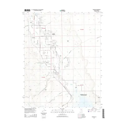
2014 Map of Overton
USGS Topo · Published 2014About this map
The Muddy River defines the corridor of the Moapa Valley, where a sequence of agricultural and residential settlements including Overton, Logandale, Glassand, and Amber contrast with the surrounding Mojave Desert. This modern survey illustrates a landscape shaped by water management and aviation, featuring Bowman Reservoir and Honeybee Reservoir alongside the runways of Perkins Field. The southern portion of the map is dominated by the northern reaches of the Lake Mead National Recreation Area, where the river meets the vast waters of Lake Mead at Virgin Basin. Elevated landforms such as Mormon Mesa and Overton Ridge frame the valley, while a dense network of residential streets, from Bonelli Ave to W Liston Ave, marks the local community's growth. Geologists and local historians can trace the intricate drainage patterns of Magnesite Wash and Logan Wash as they descend toward the central valley floor.
Find a feature on this map
61 named features on this map. Tap any name to fly to it.
Don’t see what you’re looking for? This feature index may not catch every label — zoom into the map to look around manually.
Map Details
Editions of this 2014 Overton Map
This is the sole edition of this map. No revisions or reprints were ever made.
Other maps of this area

1886 · Saint Thomas
USGS Topo · 1:250,000

1893 · Saint Thomas
USGS Topo · 1:250,000

1926 · Bonelli
USGS Topo · 1:96,000

1926 · Boulder Canyon
USGS Topo · 1:96,000

1953 · Muddy Peak
USGS Topo · 1:62,500

1953 · Overton Beach
USGS Topo · 1:62,500

1954 · Las Vegas
USGS Topo · 1:250,000

1957 · Las Vegas
USGS Topo · 1:250,000

1958 · Moapa
USGS Topo · 1:62,500

1958 · Overton
USGS Topo · 1:62,500