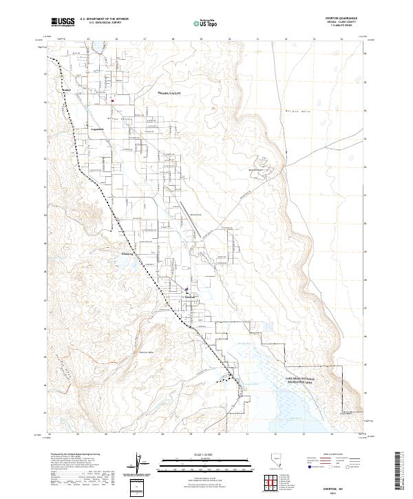
2021 Map of Overton
USGS Topo · Published 2021About this map
The Muddy River defines the fertile floor of the Moapa Valley, a corridor of long-standing agricultural settlement that includes the communities of Logandale, Overton, Amber, and Glassand. This 2021 survey shows how the residential and aviation infrastructure, such as Perkins Field, is concentrated along the western edge of the valley, bounded by the steep rises of Overton Mesa and Overton Ridge. The landscape transitions sharply from these irrigated valley lands to the arid expanses of the Mojave Desert and the high flats of Mormon Mesa to the east.
Find a feature on this map
97 named features on this map. Tap any name to fly to it.
Don’t see what you’re looking for? This feature index may not catch every label — zoom into the map to look around manually.
Map Details
Editions of this 2021 Overton Map
This is the sole edition of this map. No revisions or reprints were ever made.
Other maps of this area

1886 · Saint Thomas
USGS Topo · 1:250,000

1893 · Saint Thomas
USGS Topo · 1:250,000

1926 · Bonelli
USGS Topo · 1:96,000

1926 · Boulder Canyon
USGS Topo · 1:96,000

1953 · Muddy Peak
USGS Topo · 1:62,500

1953 · Overton Beach
USGS Topo · 1:62,500

1954 · Las Vegas
USGS Topo · 1:250,000

1957 · Las Vegas
USGS Topo · 1:250,000

1958 · Moapa
USGS Topo · 1:62,500

1958 · Overton
USGS Topo · 1:62,500