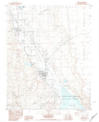
1983 Map of Overton
USGS Topo · Published 1984About this map
Overton and Logandale anchor this Moapa Valley landscape in the early 1980s, where agricultural patterns meet the encroaching waters of Mead Lake. The Muddy River and Virgin River converge near the southern end of the sheet, feeding into the Lake Mead National Recreation Area and the Overton Wildlife Management Area. Local infrastructure is well-defined, from the Union Pacific rail line and a prominent Horse Track to the Overton Airport and an Aban Landing Strip. The map also captures the industrial footprint of the region with several Borrow Pits and a Gravel Pit. To the east, the flat expanse of Mormon Mesa contrasts with the southern reaches of Valley of Fire State Park, illustrating the transition from desert plateau to managed wetlands.
Find a feature on this map
27 named features on this map. Tap any name to fly to it.
Don’t see what you’re looking for? This feature index may not catch every label — zoom into the map to look around manually.
Map Details
Editions of this 1983 Overton Map
This is the sole edition of this map. No revisions or reprints were ever made.
Other maps of this area

1886 · Saint Thomas
USGS Topo · 1:250,000

1893 · Saint Thomas
USGS Topo · 1:250,000

1926 · Bonelli
USGS Topo · 1:96,000

1926 · Boulder Canyon
USGS Topo · 1:96,000

1953 · Muddy Peak
USGS Topo · 1:62,500

1953 · Overton Beach
USGS Topo · 1:62,500

1954 · Las Vegas
USGS Topo · 1:250,000

1957 · Las Vegas
USGS Topo · 1:250,000

1958 · Moapa
USGS Topo · 1:62,500

1958 · Overton
USGS Topo · 1:62,500