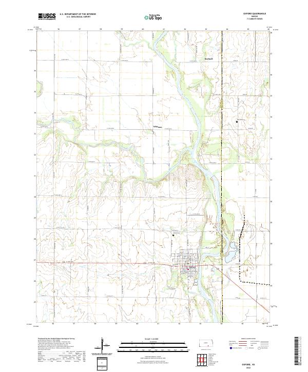
2022 Map of Oxford
USGS Topo · Published 2022About this map
The confluence of the Arkansas River and Ninnescah River anchors this study of south-central Kansas, where the town of Oxford sits just west of the winding riverbed. The landscape is defined by the hydraulic history of the area, evidenced by the Mill Race and numerous creek systems like Antelope Cr and Lost Cr that drain the surrounding plains. The settlement pattern follows a rigid section-line grid, typical of the regional township and range system, with named locations such as Whitman and Bushnell marking specific points along the rural road network. Local history and genealogy interests are grounded by the presence of the Oxford Cem and Ninnescah Cem, which serve as permanent markers of the community's ancestral roots. The boundary between Sumner Co and Cowley Co runs along the eastern edge of the quadrangle, primarily following the course of the Arkansas River as it meanders through the fertile valley floor.
Find a feature on this map
60 named features on this map. Tap any name to fly to it.
Don’t see what you’re looking for? This feature index may not catch every label — zoom into the map to look around manually.
Map Details
Editions of this 2022 Oxford Map
This is the sole edition of this map. No revisions or reprints were ever made.
Other maps of this area

1890 · Wellington
USGS Topo · 1:125,000

1955 · Udall
USGS Topo · 1:24,000

1955 · Belle Plaine
USGS Topo · 1:24,000

1955 · Mulvane
USGS Topo · 1:24,000

1955 · Wichita
USGS Topo · 1:250,000

1958 · Wichita
USGS Topo · 1:250,000

1964 · South Haven NE
USGS Topo · 1:24,000

1964 · Dalton
USGS Topo · 1:24,000

1965 · Adamsville
USGS Topo · 1:24,000
1965 · Hackney
USGS Topo · 1:24,000