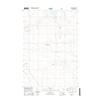
2014 Map of Ozark SE
USGS Topo · Published 2014About this map
Hiawatha National Forest preserves a vast wetland and forest landscape in the Upper Peninsula, dominated by the intricate drainage systems of the Carp River and its numerous tributaries. This survey shows the serpentine path of the N Br Carp River as it moves through the western sections to meet the main stem, while smaller water bodies like Spring Lake and East Lake dot the northern terrain. The absence of developed townsites highlights the protected status of the land, which is instead marked by recreation and resource management. Long-distance travelers and local hikers can trace the route of the N Country National Scenic Trail as it winds across the township lines. The hydrology is particularly dense in the south, where Paquin Lake sits near the headwaters of Red Cr and the Little Cut River.
Find a feature on this map
19 named features on this map. Tap any name to fly to it.
Don’t see what you’re looking for? This feature index may not catch every label — zoom into the map to look around manually.
Map Details
Editions of this 2014 Ozark SE Map
This is the sole edition of this map. No revisions or reprints were ever made.
Other maps of this area

1931 · St Ignace NW
USGS Topo · 1:31,680

1931 · Moran NE
USGS Topo · 1:31,680

1931 · Ozark SE
USGS Topo · 1:31,680

1948 · Moran NE
USGS Topo · 1:31,680

1948 · Moran NW
USGS Topo · 1:31,680

1953 · Fibre
USGS Topo · 1:24,000

1954 · Sault Sainte Marie
USGS Topo · 1:250,000

1955 · Cheboygan
USGS Topo · 1:250,000

1956 · Sault Sainte Marie
USGS Topo · 1:250,000

1957 · Sault Sainte Marie
USGS Topo · 1:250,000